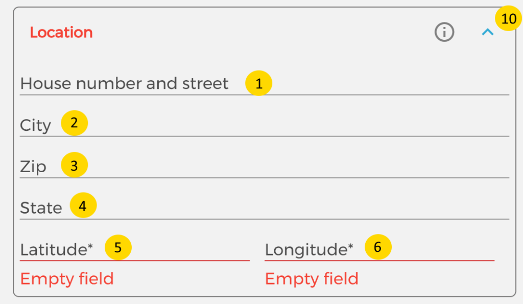


The location form is used in multiple places.
It is constructed of 2 parts, the address itself and GPS coordinates as latitude and longitude.
The address is used to visualize the user’s or pool address.
The GPS coordinates are for navigation use and calculating the optimal route.
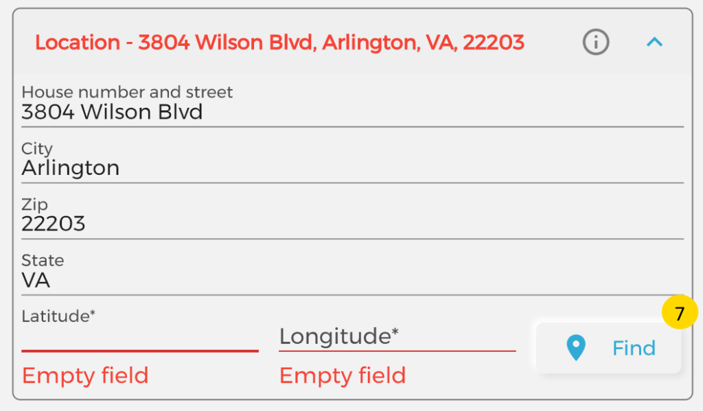
If you enter the Street(1*), City(2*), Zip(3*) and State(4*), the button Find(7*) will appear.
It is important when you enter any of the address fields to hit Enter on the keyboard that will lead you to the next field!
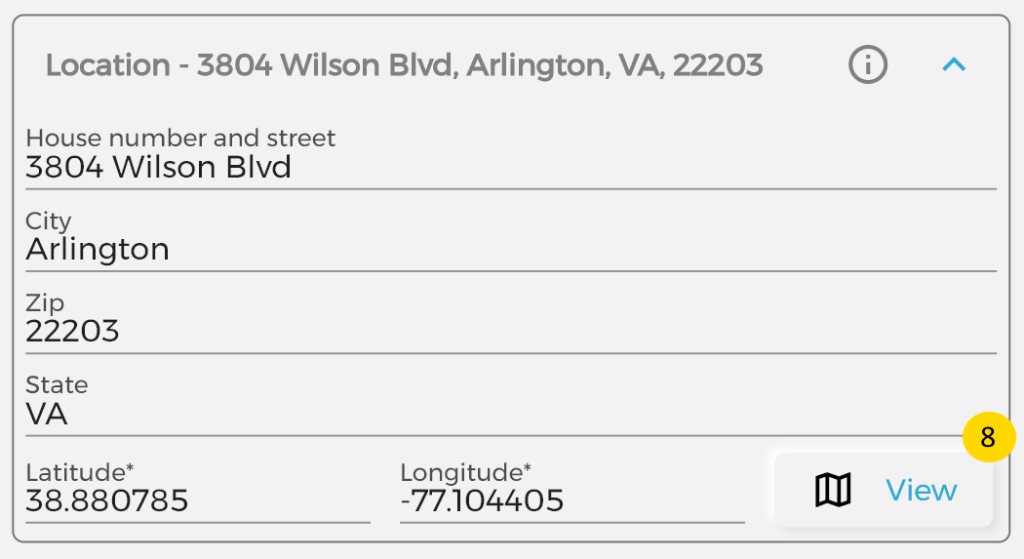
If you click on Find(7*) button the system will find the GPS coordinates for you and populate the Latitude(5*) and Longitude(6*) fields for you.
Important, the Find button will work only if you have set a Mapbox key in the settings!
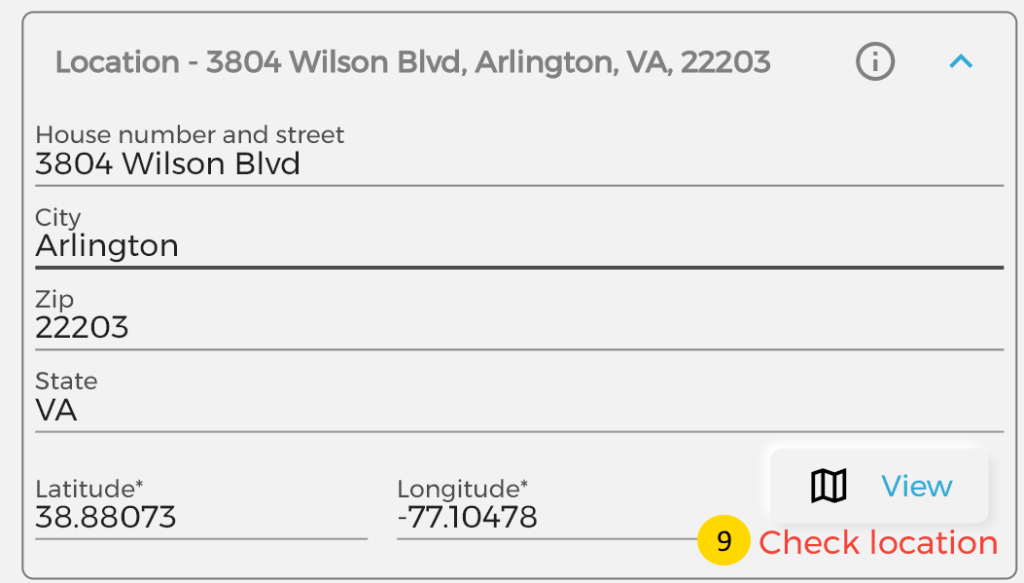
Sometimes the found location from the address may not be 100% guaranteed, in that case you will see a warning message “Check location”(9*).
Once the Latitude(5*) and Longitude(6*) fields are populated, the button View(8*) will appear on the place of Find(7*) button. With the View(8*) button you can see the GPS location on the Map as a pin. This is useful if the warning message “Check location”(9*) is shown and validated manually on the map if that is the place.
If you have just the coordinates of a place you can enter them and see the address on the map.